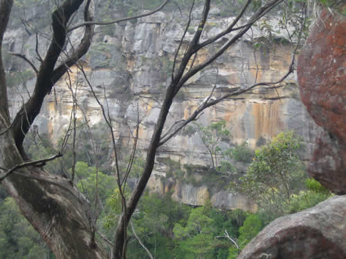
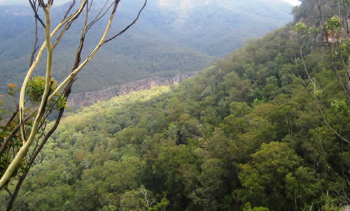
Morton National Park is one of NSW’s largest parks, containing a considerable section of The Southern Highlands. Whether you are an experienced bushwalker looking for remote wilderness hiking, a novice mountain biker looking for an easy ride or a keen photographer looking for some scenic waterfalls to capture this enormous park has something for everyone. Size: 162 000 ha. Access: The park is easily accessible from Bundanoon, Kangaroo Valley, Nowra and Ulladulla, so it makes for a great day trip or weekend getaway. There are numerous access points to the perimeter and one main road, the Nowra-Braidwood Road, runs through the park and is passable by 2WD vehicles. The north side of the park, provides the visitor’s centre at Fitzroy Falls and Bundanoon gives access to a number of shorter walks. Highest point: 880 metres Lowest point: 10 metres Main rivers: Shoalhaven River, Clyde River, Kangaroo River.Morton National Park is always open but may have to close at times due to poor weather or fire danger.
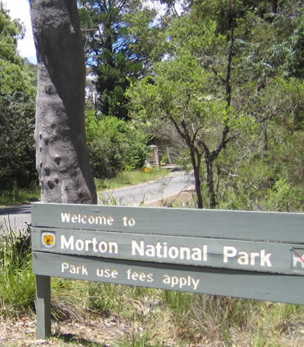
Vehicle entry feesIn this park, vehicle entry fees are $7 per vehicle per day. Vehicle entry fees apply in the Fitzroy Falls and Bundanoon areas of the park. There are coin-operated ‘pay and display’ machines – please bring correct coins. Walking TracksThere are numerous walking tracks through Morton National Park. The walks abound in native flora. Walks vary in length and difficulty and you should choose the walk to suit your needs. For more information on the Walking Tracks in Morton National Park, please click here. Fastfind Quicklink
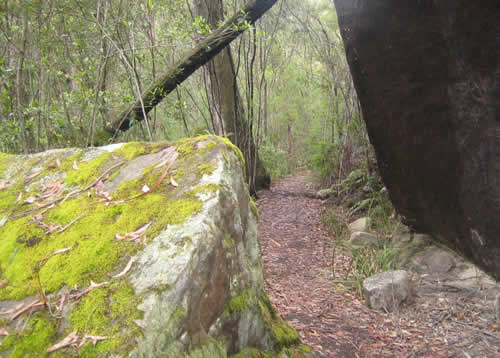
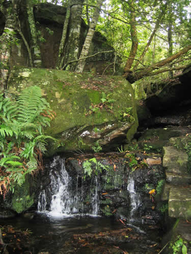
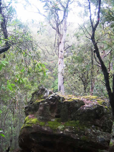
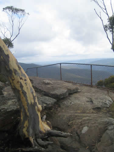
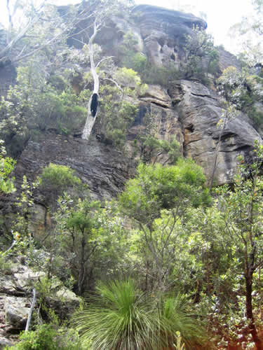
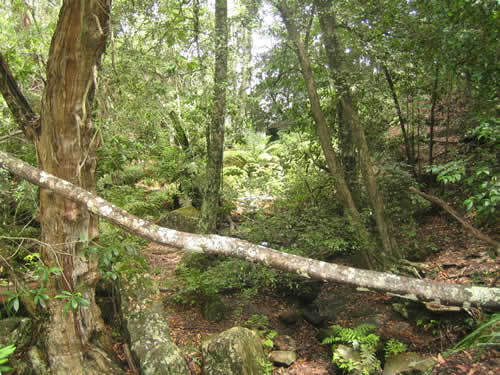
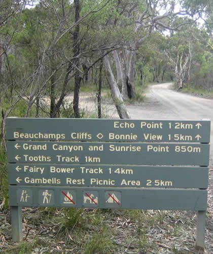
Erith Coal Mine Track(1 hour return) Start: Gambells Rest Grade: Steep This short, steep walk through woodland, heath and rainforest leads to a mine that was open from the 1860s to 1915. The metre thick coal seam was of poor quality and only used for goods engines. For safety reasons, fencing prevents entry to the mine. This walk can also be undertaken from the Erith Coal Mine car park off Echo Point Road. Echo Point and Lovers Walk(1 hour loop) Start: Echo Point picnic area . Grade: easy Take the Lovers Walk turn-off on the right and follow the track to Bonnie View for a spectacular panorama. Return along the road, passing the Wishing Well on your left. Where the road divides, keep left and then left again back to the picnic area. For more information about this track please click here. Mount Carnarvon Track(30 minutes return) Start: Echo Point picnic area . Grade: easy, some steps A short, pretty walk through bushland to the escarpment returning the same way. For more information about this track please click here. Fern Glen Track(15min return) Start: Grand Canyon Picnic Area . Grade: easy This short walk leads to a moist, rocky haven – home to some gigantic king ferns and other moisture-loving plants. Fairy Bower Scenic Circuit(1 hour loop) Start: Gambells Rest car park . Grade: steep Walk through the back of the camping area along the road to the Fairy Bower sign on the left. Follow this track to the junction of the track from the Fairy Bower car park. Keep to the left until you reach the creek and the lookout above Fairy Bower Falls. For further information about this track please click here. (Note: no access to falls) Return the same way or via the Fairy Bower car park, returning to Gambells Rest along the road. Tooths Lookout/Fairy Bower Falls Walk(1.5 hr return) Start: Tooths Lookout car park . Grade: very steep Follow Bundanoon Creek Track down a very steep incline near the lookout. Turn left along Nicholas Pass to Fairy Bower Falls where you will delight in the lush, green rainforest. Return same way. Bundanoon Creek Trail(2 hr return) Start: Tooths Lookout car park . Grade: very steep Follow the track down a very steep incline (past the Fairy Bower Falls turn-off) to Bundanoon Creek. Cool off in the creek before the steep climb back. Make sure you allow plenty of time to complete this walk in daylight. For further information about this track please click here. Amphitheatre Walk(3 hr loop) Start: Gambells Rest car park . Grade: medium (steps) Take the road outside the park (Gullies Road) to Riverview Road and turn right. Follow the road to the junction, turn right and follow the sign to the Amphitheatre. Follow this track (Nicholas Pass) under the cliff and stop off at Fairy Bower Falls. Continue along the pass to the T junction with Bundanoon Creek Track and turn right. Climb this steep track to Tooths Lookout, then follow the signs back to Gambells Rest. Riverview Walk(40min return Riverview lookout) (1.5 hr return to Glow Worm Glen) Start: Amphitheatre car park . Grade: medium A pretty walk across Fern Tree Gully through dry eucalypt forest to Riverview Lookout. Continue on to Glow Worm Glen by following Riverview Road north until it meets the Glow Worm Glen Track. Follow this track and turn right at track junction to Glow Worm Glen (day time only).For further information about this track please click here. Dimmocks Creek Walk(30 min return) Start: Dimmocks Creek car park . Grade: easy Short walk to Dimmocks Creek (return the same way). |
|
||